


Miami-Dade County and the rest of South Florida are under tropical storm warnings for Hurricane Ian, which is forecast to pass to the northwest of the region on Wednesday, according to the National Hurricane Center. The metro area can expect heavy rainfall, flooding and and strong winds from the outskirts of the storm.
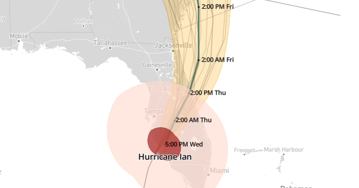
Hurricane Ian made landfall Wednesday afternoon as a Category 4 storm near Punta Gorta on Florida’s west coast and is tracking northeast toward the Orlando and Central Florida areas, according to the National Hurricane Center.
Severe and widespread effects will follow along Ian’s path even miles from the storm’s center, including heavy rain, wind, tornadoes and flooding are expected.
Hurricane and tropical storm warnings and watches are in effect on both coasts of the state.
Here’s the latest forecast track including the so-called “spaghetti models,” which show the range of possible tracks based on various computer models:
Read More: Will Hurricane Ian hit Miami? Here’s the latest forecast path – Sun Sentinel


