


Posted:
Updated:
More sunshine is on the way today with another shot at near-record highs heading into the late afternoon. Temperatures this morning are already quickly rising, and Indianapolis will likely hit the 80° by the lunch hour. The projected highs are in the upper 80s by the evening rush hour.

Clouds will build this evening and overnight with mild temperatures. The additional clouds are associated with a pattern change as a storm system nears the Ohio Valley.

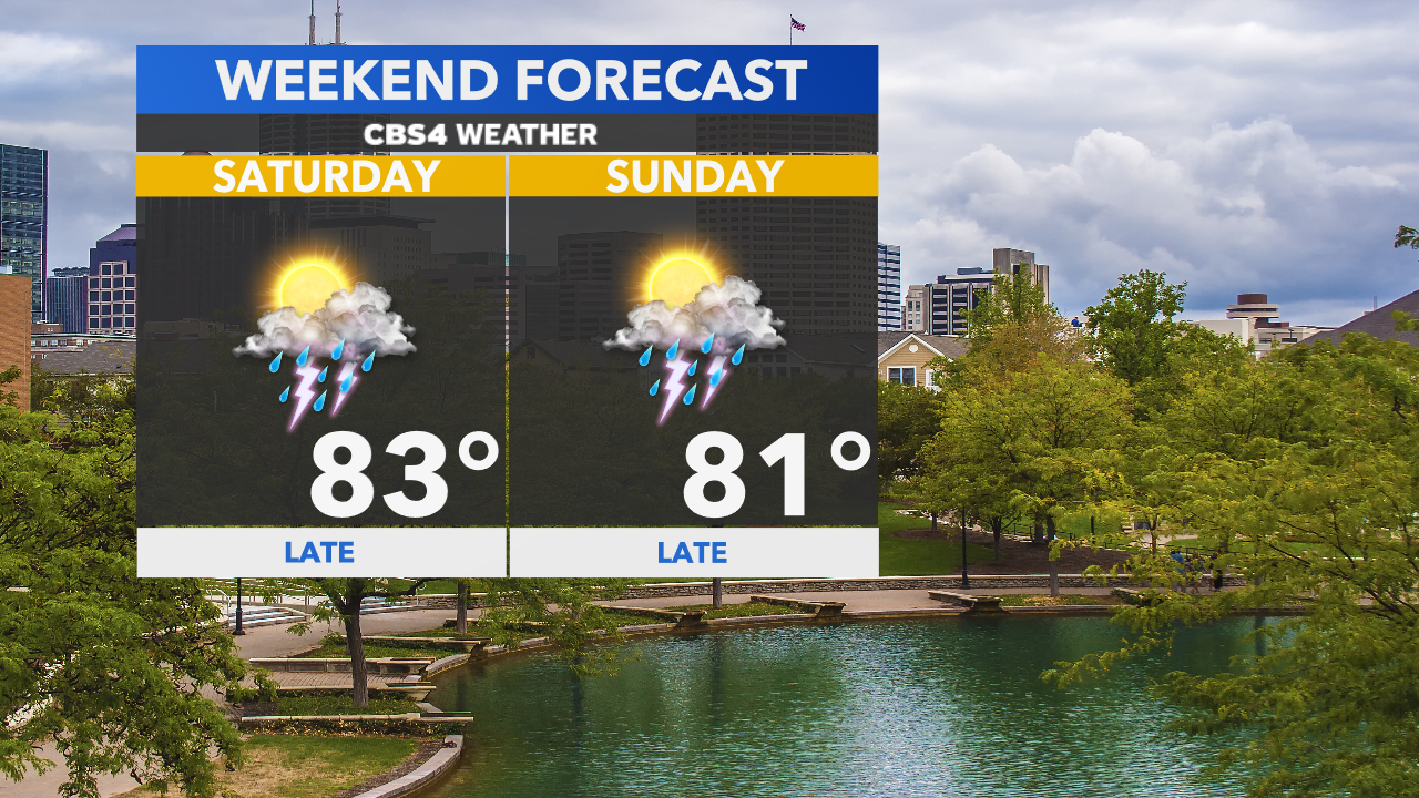
The weather is going to be much more active after seeing a six-day dry stretch! Storm chances will ramp up Saturday afternoon. The coverage will increase during peak heating and a couple storms may pack a punch. Main threats include gusty winds and small hail.

A more favorable severe weather threat exists Sunday evening ahead of an approaching cold front. Highs will still climb into lower 80s, but the unseasonably warm air and humidity may trigger a few stronger storms on Sunday.


After showers and storms depart Monday morning, temperatures will cool off a touch. Highs in the 70s return to the area next week.

Read More: Warm weather to wrap-up the workweek


