


LAS VEGAS, Nev. (FOX5) – What areas of the Las Vegas valley are the hottest? Volunteers came together to try to answer that question. On Saturday, 28 teams of volunteers drove around the valley for 3 hours; one hour in the morning, one in the afternoon, and one hour at night, all the get readings of temperatures at the exact same time with the goal of creating a compressive heat map.
“I am actually an environmental science major so this to me is super important,” Liz Becker told FOX5. Becker volunteered as a citizen scientist, part of one of the two-person teams.
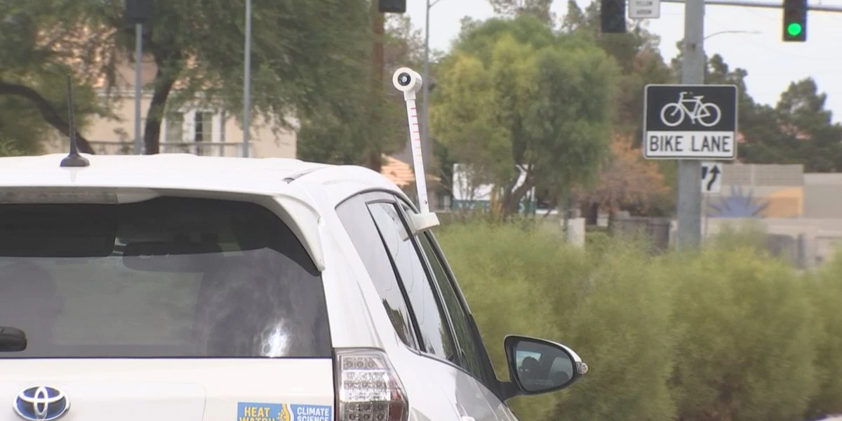
The 2022 NOAA Urban Heat Island Mapping Campaign aims to help better understand what areas of Metro Las Vegas are most impacted by extreme heat. The federal weather agency sent temperature sensors to Vegas that were mounted to cars.
“It is custom made and it fits on the window of the car and it goes up above the vehicle, so it doesn’t get the heat off your car and it measures the humidity and the temperature in the air, and it’s got a GPS locator on it, so it is very specific to GPS coordinates as it moves,” Becker shared.
Becker’s assigned route for each of the three reading hours was a 16-mile loop.
“They created the routes so we would be going by different kinds of areas, so like a park… is going to lower the ambient air temperature, whereas if you are surrounded by concrete in parts of town, that is going to have a higher ambient air temperature,” Becker said.
That is what is known as the “heat island effect,” higher temperatures in areas with more concrete, asphalt, and buildings (often in a city’s urban core) where materials hold more heat from the sun.
“We are able to take that information and use it to mitigate heat in areas where we are experiencing higher temperatures,” stated Sue Christiansen. Christiansen with RTC of Southern Nevada (who is partnering with NOAA on this mapping effort) said they will use the data to try and cool areas found to be the hottest.
“By adding more trees, shelter, different ways that we can help,” Christiansen explained.
All of that data collected Saturday is still being compiled and analyzed by scientists to create the heat map.
The heat mapping experiment will be repeated in the future to see if climate change is making the Vegas Valley hotter. Las Vegas is one of 14 cities taking part in the research. The City of Las Vegas has pledged to plant 30,000 trees over the next 30 years to mitigate urban heat islands.
Copyright 2022 KVVU. All rights reserved.
Read More: Volunteers help map “urban heat islands” in Las Vegas Valley


