


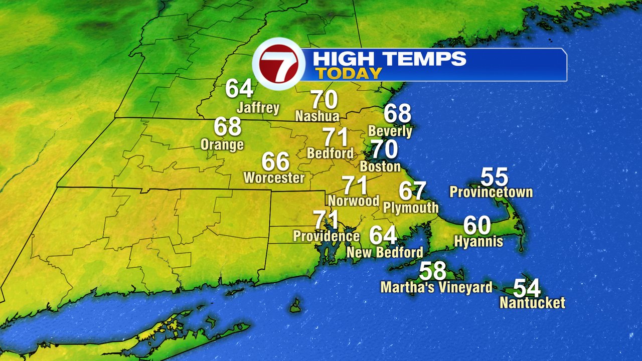
Needed a little patience for it, but once the sunshine broke out yesterday, it turned into a stellar Spring afternoon as highs took off, soaring to near 70. While we’ll have more clouds mixed in with the sun at times this afternoon, temps will be close to repeating yesterday afternoon, with highs once again pushing 70. It’ll be a bit cooler along the south coast vs. yesterday thanks to a wind direction change to the south/southwest. While much of today is dry, a few late day showers near the MA/NH border are possible, but most of the rain stays north of us during the daylight hours.

That’ll change overnight as scattered showers move in across Southern New England with temps in the 40s to near 50. Early morning scattered showers taper off tomorrow morning and mainly dry air prevails from mid morning, through late afternoon.

The forecast challenge tomorrow is going to be the placement of a front that divides chilly ocean air from summer-like warmth. There will be a time tomorrow when the temps near 50 in Boston but near 80 in Hartford, CT! Talk about a gradient! Showers and storms increase in coverage area around dinner time, and linger into the evening.


Showers taper off predawn Friday allowing for dry and mild day with temps near 60 at the coast, 65-70 inland. Saturday is mild too, 65-70 with dry weather through mid afternoon. Late Saturday afternoon and into Saturday evening, we’ll track a cold front producing showers/storms that’ll track through the area. Behind the front, Easter Sunday looks cooler and breezy but mainly dry with highs in the low to mid 50s. Marathon Monday looks good for the runners too with temps in the 50s and a light north to east breeze. It’ll be dry too.

Read More: Temps On Repeat… For Now – Boston News, Weather, Sports


