


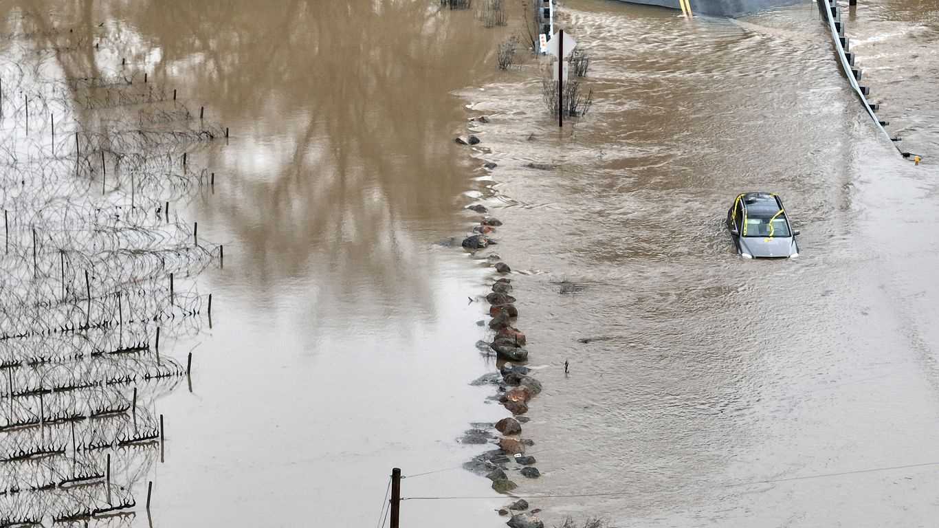
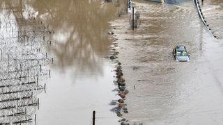
A car is submerged in floodwater after heavy rain moved through the area on Jan. 9, in Windsor, Calif. Photo: Justin Sullivan/Getty Images
The most powerful in a “relentless parade” of atmospheric rivers is bearing down on California Tuesday through Wednesday. It has brought with it widespread flash flooding, river flooding, mudslides and staggeringly high mountain snowfall totals.
The big picture: The latest deadly storm has triggered evacuations and the closure of schools and roads across California due to the threat of “torrential rain, widespread flooding, rapid water rises, mudslides and landslides with possible debris flows, heavy mountain snow and gusty high winds,” per the National Weather Service.
- Authorities called off the search for a 5-year-old boy who was swept away in floodwaters near Paso Robles in central coastal California, as the death toll from the barrage of severe storm systems increased to 14 Monday, AP reports.
By the numbers: The NWS issued flood watches Monday for over 34 million Californians — about 90% of the state’s population.
- Nearly all of California has received rainfall totals 400% to 600% above average in the past several weeks, the National Weather Service noted in a forecast discussion.
- Santa Barbara County’s Cachuma Reservoir has risen almost five feet in 24 hours — and San Marcos Pass has seen more than 12 inches of rainfall during this period, NWS warning coordination meteorologist Eric Boldt said at a briefing. “As far as we kn0w, this is a historical record,” he added.
Meanwhile, an estimated 63,600 customers were without power Monday night.
Between the lines: The whiplash from a bone-dry to flood-prone state is a demonstration of how human-caused climate change is accentuating California’s naturally fickle precipitation patterns.
- While flooding, power outages and landslides threaten Californians in the near-term, these storms are boosting reservoir levels, severely depleted by the Southwest’s megadrought.

State of play: Among the evacuation orders issued in response to the storm was one for the entire town of Montecito in Santa Barbara County, on the fifth anniversary of a mudslide that killed 23 people there, per AP.
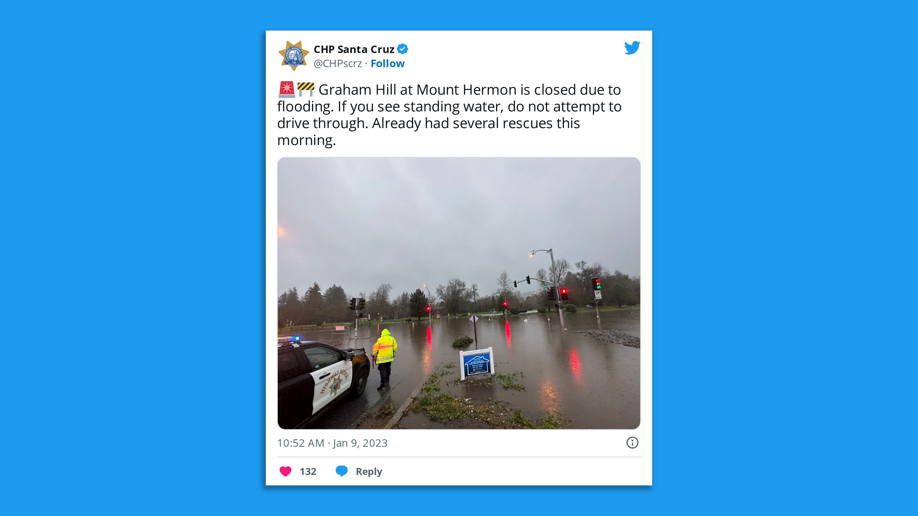
- Flash flood warnings were issued for Santa Cruz and counties across the state, as the California Highway Patrol reported water rescues taking place in Santa Cruz and other areas.
- NWS meteorologist Eric Boldt said at a press conference with Santa Barbara County officials Monday that parts of the county’s mountain and foothills areas could see rainfall totals of nearly a foot.
Threat level: These storms have caused debris flows and flash flooding in areas where the ground has been weakened by recent wildfires, with multiple flood warnings associated with burn scars issued across Central California.
- They’re also priming the slopes of the Sierra Nevada Mountains for avalanches.
- Total snowfall through Tuesday is predicted to be upwards of 6 feet for elevations above 7,000 feet, per the NWS. Some places have already seen 100 inches pile up in the past two weeks.
- The NWS Weather Prediction Center notes there’s a greater than 50% chance that flash flood thresholds will be exceeded from Sacramento to the hills of Southern California.
- Severe thunderstorms were possible overnight into Tuesday from San Francisco to Los Angeles, a rarity for this region. These storms may contain damaging winds, hail and very heavy rainfall that could lead to more flooding.
What we’re watching: The flood threat on Tuesday centered more in Southern California, with up to a foot of rain falling in the hills of Los Angeles, Santa Barbara…
Read More: Mass evacuations as atmospheric river brings flooding


