


The Fredericksburg and Warrenton storms — with estimated winds over 80 mph — downed hundreds of trees and led to more than 100,000 power outages.
The Fredericksburg storm first developed north of the District before erupting in Prince William County, where it first caused wind damage. The storm then bolted southward along Interstate 95 taking down trees and wires all along its path — which ended south of Richmond. Winds were intense enough to strip siding from homes and even shift a shed off its foundation, according to reports from the National Weather Service.
This was the super intense storm that hit Fredericksburg earlier with violent downburst winds. Fast forward to around 25 seconds. https://t.co/zzIzt9xbx9
— Capital Weather Gang (@capitalweather) June 22, 2022
The Warrenton storm was comparably intense. It first caused tree damage in southern Loudoun and northern Fauquier counties around Middleburg and the Plains. It downed “dozens of trees” near Marshall, according to the Weather Service. In west-central Fauquier County, including Warrenton, there were “hundreds of trees blown down, many into homes with at least three structure collapses,” the Weather Service wrote. The storm also toppled trees around Culpeper before the storm weakened.
Amid the numerous storms that swept through the region, there were also several reports of homes struck by lightning. At least one firefighter was hurt responding to lightning strike at a home in Loudoun County.
The storms lined up into north to south rows like trains along a track, unloading tremendous rainfall in some areas.
Some of the heaviest rain focused along and just west of Interstate 81, where streams overflowed and roads were closed.
Around Washington, a train of storm cells that stretched as far north as central Pennsylvania cycled through the area starting around 7:30 p.m. and continued well after midnight. Minor flooding was reported along Rock Creek at Sherrill and Beach drives, where several vehicles were stranded or disabled.
Generally one to two inches of rain fell in the Beltway region; across the broader region amounts varied from around 0.1 to over 3 inches. Here are some of the totals:
- Woodbridge: 3.1 inches
- Front Royal: 2.5 inches
- Fairfax: 2.29 inches
- Fort Belvoir: 2.18 inches
- Reagan National Airport: 1.86 inches
- Rockville: 1.78 inches
- Winchester: 1.4 inches
- Dulles: 1.00 inches
- BWI Marshall: 0.66 inches
Explaining the storminess
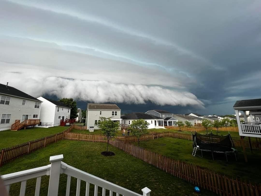
The Fredericksburg and Warrenton storms were isolated and occurred roughly one hour and 40 miles apart. The systems were compact, bow-shaped thunderstorm complexes that traveled rapidly from north to south — an atypical motion for our region during summer.
The storms initiated and tracked along a north-south oriented frontal boundary and were being steered by a deep flow of wind from the north.
The first complex congealed near Dale City around 2:15 p.m. and tracked south along I-95 before dissipating south of Richmond. The radar animation of the system is shown below. In the animation, the left panel shows radar reflectivity (the intensity of rain) while the right panel reveals Doppler-derived wind speed.
The storm complex initiates as an undulating, solid arc of cells which then rapidly bows out and elongates toward the south. A powerful surge of downdraft wind was responsible for the transformation to a bowing shape. Those winds were detected by the Doppler radar in Sterling, Va., and shown by the patch of orange colors along…
Read More: How violent storms and a ‘rain train’ blasted D.C. area


