


INDIANAPOLIS – Temperature this week will not fluctuate much day-to-day, but that does not mean it will remain steady. The diurnal range, or difference between low & high temperature, will be quite large with dry air spread out across the region.
Seasonable early week weather
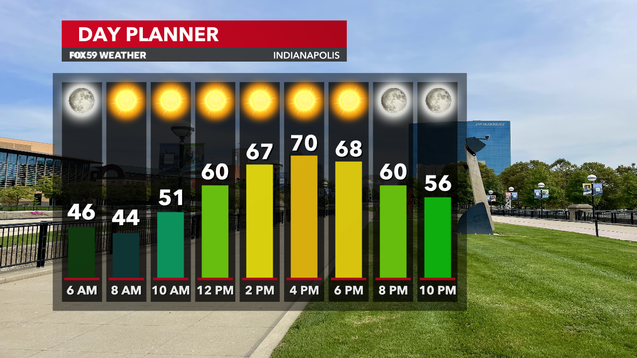
Comfortable weather will be the story of the week, but you may need to prepare for what will feel like two different seasons. We will begin Monday with temperatures in the low & mid 40s as quiet & clear overnight conditions allow for sharp cooldowns. Bright & sunny conditions along with dry air during the day will help us warm up quickly. Afternoon highs are expected to climb to around 70 degrees as a result.

We will continue to ride the diurnal rollercoaster as we progress through the week, and it will become more amplified on Tuesday & Wednesday with high pressure beginning to settle directly overhead. Each day is expected to remain mostly to completely sunny with bountiful dry air. Tuesday may range from morning lows around 40 to high around 70 by the afternoon. Similar weather is expected on Wednesday too, though it may be a few degrees warmer on both ends of the day; mid 40s to mid 70s.

Big shift in temperatures late week
On Thursday, a cold front will approach the region and this will shake up our weather quite a bit. The day will turn out mild with highs in the mid 70s, though it will become cloudier in the afternoon. Isolated showers are possible towards the back end of the day as well.

The cooler weather will blast into the state on Friday with breezy conditions throughout. This appears to be a very good candidate for our first day under 60 degrees entirely and the following night is likely to find its way into the upper 30s for the first time too! Saturday will be another cool day with the first frost of the year for much of Central Indiana coming on Sunday morning (if not the day prior).

Read More: Keep both the jacket & shorts handy for this week


